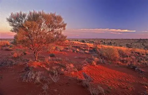
There is a line that appears in Australian geography textbooks about the Simpson Desert. It describes an area of roughly 176,500 square kilometres — about the size of Cambodia — known for long parallel sand dunes, extreme aridity, and some of the lowest annual rainfall totals on Earth. It is a landscape defined by dryness. The desert is not supposed to flood.
In late February 2026, it did.


A tropical low-pressure system that developed over northern Australia drifted south and then, around February 22, stalled over the Simpson Desert and surrounding interior regions. For nearly a week the system remained stationary — something meteorologists described as highly unusual for that location and time of year. During that time it continuously drew tropical moisture from the north and released it in sustained, intense rainfall across terrain not designed to absorb such volumes of water.
Some remote monitoring stations recorded more than 600 millimetres of rainfall during the event. To understand the scale of that number, Sydney’s monthly average rainfall typically ranges between 100 and 120 millimetres. Broken Hill in western New South Wales receives around 230 millimetres in an entire year. Parts of the Simpson Desert received what many inland communities might normally expect across several years of rainfall — in less than a week.
Major flood warnings were issued for river systems across four Australian states at the same time. The Georgina River in Queensland and the Flinders River in the Gulf Country both experienced major rises, while inland catchments across the Northern Territory, South Australia and New South Wales were also affected. The Bureau of Meteorology tracked elevated water levels across an enormous stretch of the continent.
Emergency crews carried out several rescues during the event as floodwaters cut off remote road networks. Near Doomadgee in Queensland, a man was rescued from the roof of his vehicle after rising floodwaters surrounded it. In the Northern Territory, police located the body of a man reported missing after swimming in the Lander River near Willowra, northwest of Alice Springs. Authorities noted the death occurred during the extreme weather event but had not formally attributed it to the flooding at the time of reporting.
Both the Northern Territory government and the Australian federal government declared the flooding a natural disaster. The declaration allowed disaster assistance funding to be released and enabled the deployment of additional emergency management resources to affected areas.
For remote and Indigenous communities scattered across this vast landscape, the flooding created immediate problems related to isolation and supply access. Many communities depend on single road links to reach towns where food, medical supplies and fuel are available. When those roads were submerged, access disappeared almost instantly. Emergency airlifts were organised in several cases, but reaching remote properties in the flooded outback requires complex logistics and careful planning.
In Oodnadatta in South Australia — one of the most remote settlements in the country and located near the edge of the Simpson Desert — supplies began to run low before the roads reopened. Residents described checking on neighbours and discovering the same situation across the town. “If the trucks can’t get through, we’ll be stuck eating baked beans,” one local told ABC Radio, summarising the reality of life in isolated regions during supply disruptions.
Weather forecasters predicted the system would gradually shift east in early March, allowing conditions to ease first across South Australia and then across other parts of the interior. However, the water that had already fallen across the desert would take far longer to drain. Flat and arid landscapes do not allow water to run off quickly. Instead, the floodwater spreads slowly and travels across the land in wide, shallow flows.
The Georgina River, which drains a huge inland catchment stretching across Queensland, the Northern Territory and South Australia, was running at levels expected to remain elevated for weeks. The Flinders River system, which had already been affected earlier in the year by monsoon rains in northern Queensland, was also carrying water from multiple upstream rainfall events.
One of the most closely watched consequences of the flooding was the possibility that Kati Thanda–Lake Eyre, the enormous salt lake in South Australia’s north, would receive significant inflows for the second year in a row. The lake fills only occasionally, and in more than 160 years of recorded observation it has never experienced substantial inflows in consecutive years.
Hydrologists monitoring the incoming data said the new floodwaters could potentially make that rare event possible. Flood watches were placed on the lake system, with water slowly moving toward it through the desert river networks.
If the lake were to reach the levels some projections suggested, it could approach or even surpass its historic 1974 depth record of six metres. The 1974 filling remains one of the most significant environmental events recorded at Lake Eyre, temporarily turning it into Australia’s largest lake and triggering widespread ecological activity across the surrounding desert.
The prospect of another major filling attracted attention from scientists, ecologists and photographers across Australia and overseas. When Lake Eyre fills, waterbirds and pelicans can appear within days, creating a dramatic natural spectacle in what is usually an empty salt basin.
However, scientists cautioned that the circumstances leading to the potential filling were not entirely positive. The flooding highlighted a broader trend that climate and hydrology researchers have been observing: increasing variability in Australia’s interior climate.
For decades the continent’s inland regions were considered relatively stable from a rainfall perspective, defined by predictable cycles of drought and occasional floods. In recent years, however, extreme weather events have begun appearing more frequently, challenging that assumption.
By early March, as the weather system finally moved east, recovery and damage assessments were beginning across affected areas. Emergency management agencies started rotating crews out of the interior, while remote stations gradually regained road access as waters slowly receded.
Assessment teams began evaluating the condition of outback road networks that had been submerged for days. Many routes serve as critical lifelines connecting isolated communities and pastoral properties to the rest of the country.
Satellite images captured during the flooding showed just how unusual the event had been. From space, the Simpson Desert looked almost unrecognisable. The long parallel sand dunes that normally run across the landscape in neat patterns were hidden beneath wide sheets of muddy floodwater.
For a brief moment, the heart of Australia’s driest desert looked like somewhere else entirely — somewhere that gets rain.


Leave a Comment